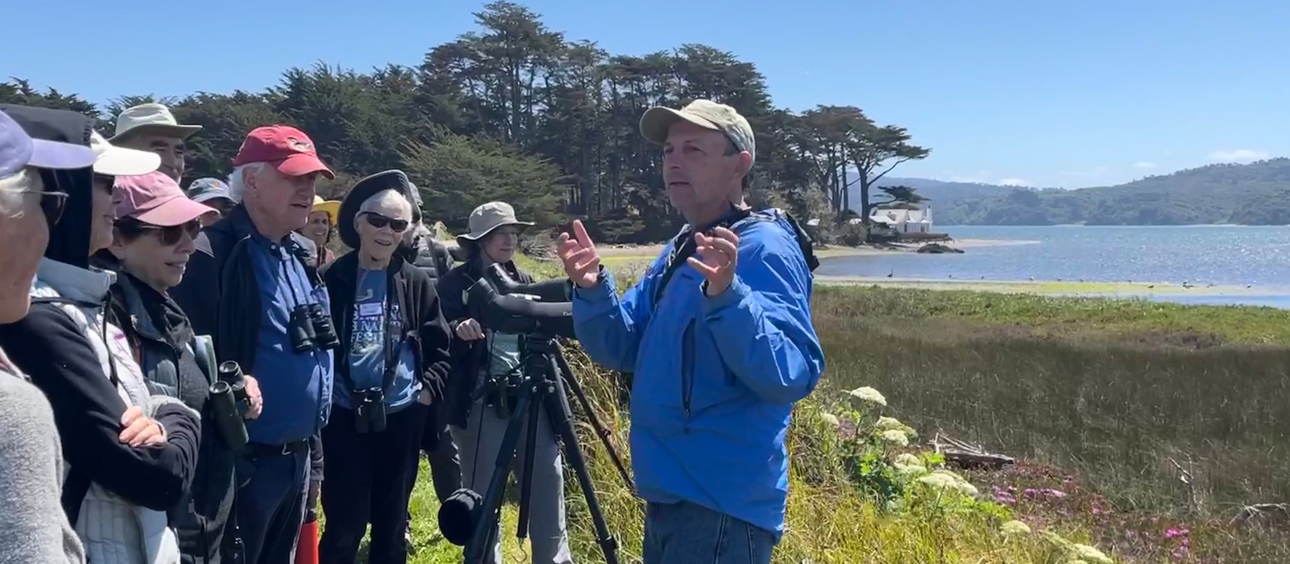
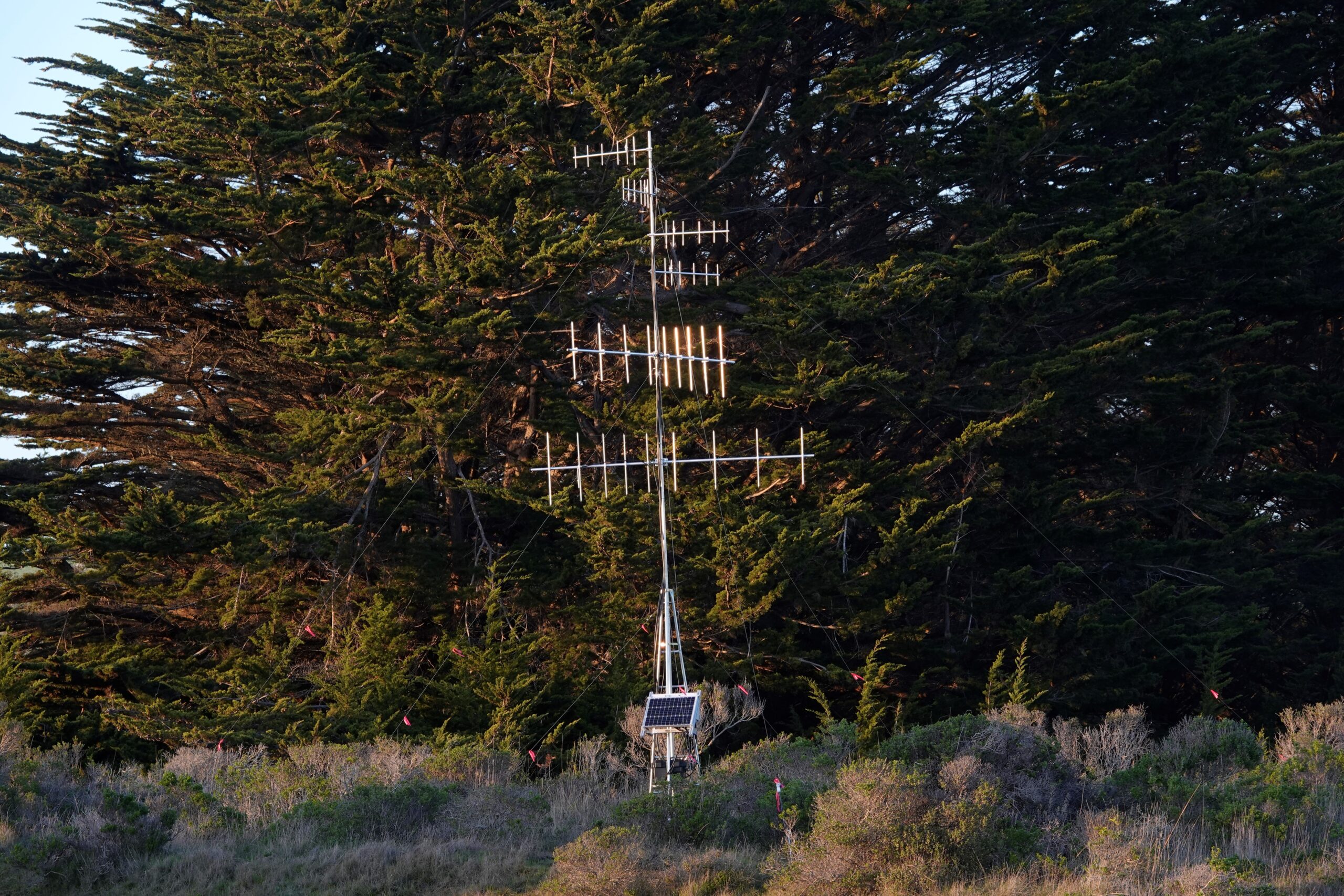
While the pandemic has raged, thanks to generous grants from the Marin Wildlife Commission and an All Hands Ecology donor, All Hands Ecology science staff have been busy this winter acquiring the equipment needed to set up two remote telemetry receiving stations (known as Motus stations) on Tomales Bay to aid in our efforts to better understand the movement ecology of our local bird populations as well as other wildlife.
Seguimiento de la fauna salvaje: sopesar las opciones
Históricamente, los biólogos utilizan un par de tecnologías probadas para seguir los movimientos de las aves y otros animales salvajes: radiotelemetría/VHF o marcas por satélite/GPS.
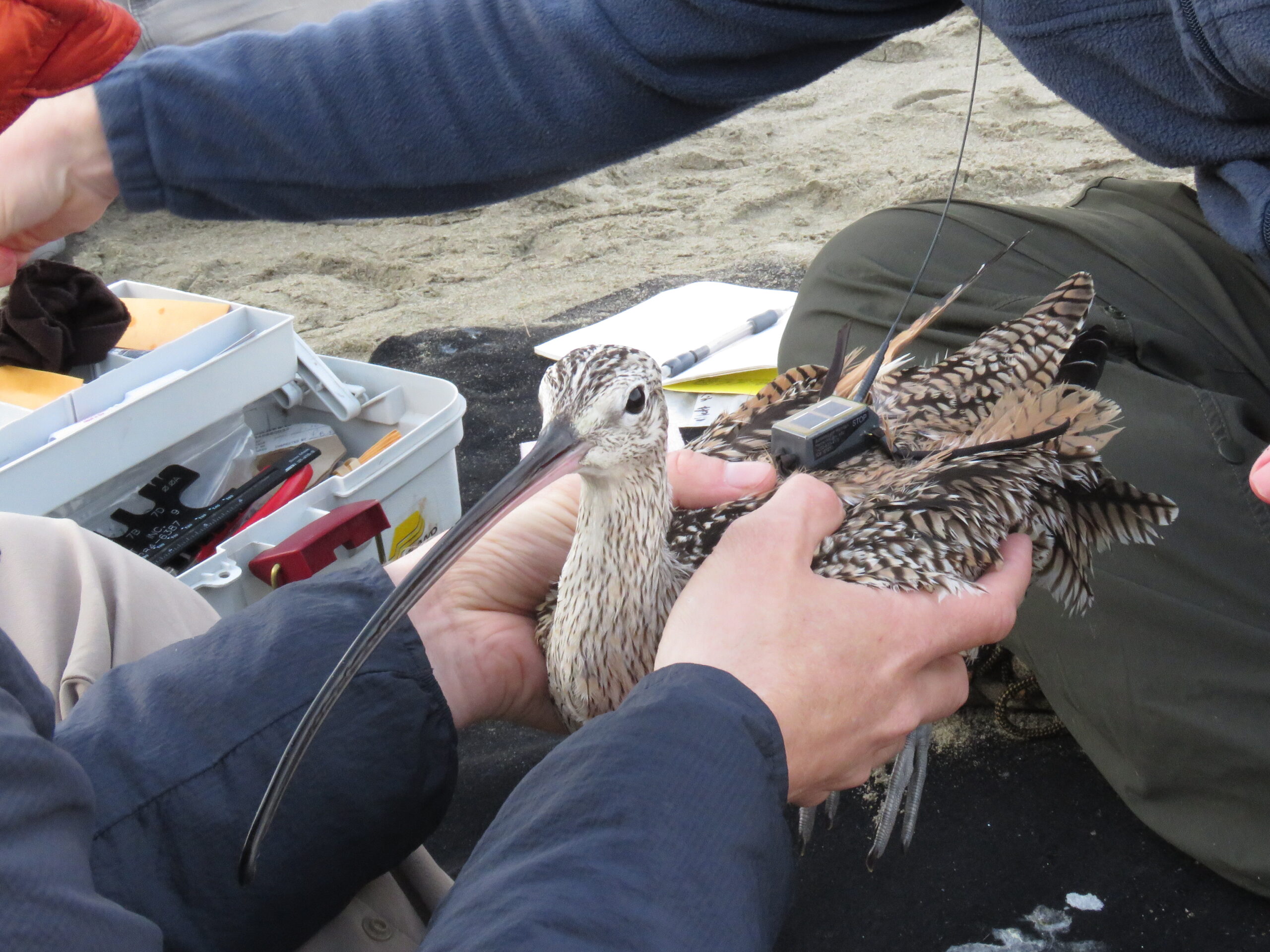
Las marcas de muy alta frecuencia (VHF) emiten una señal de baja potencia en una frecuencia específica que el biólogo escucha con un receptor portátil y una antena. Estas marcas, sobre todo las pequeñas, sólo pueden transmitir hasta 1,25 millas, por lo que el seguimiento de animales que se desplazan grandes distancias requiere o bien un conjunto de personas que escuchen en tierra o bien el uso del aire para seguir a los animales. La ventaja de estas marcas es que pueden ser lo bastante pequeñas para colocarlas en insectos como las libélulas.
El otro método de rastreo más utilizado, las marcas por satélite/GPS, utiliza grandes baterías para enviar una señal al espacio, donde los satélites en órbita pueden captar las señales y transmitir la ubicación de los animales. Se trata de un sistema estupendo para los investigadores que rastrean a distancia animales grandes, como leones de montaña, pero el tamaño de estas etiquetas suele ser demasiado grande para rastrear aves más pequeñas, que pesan menos de cuatro onzas.
Construir un modelo VHF mejor
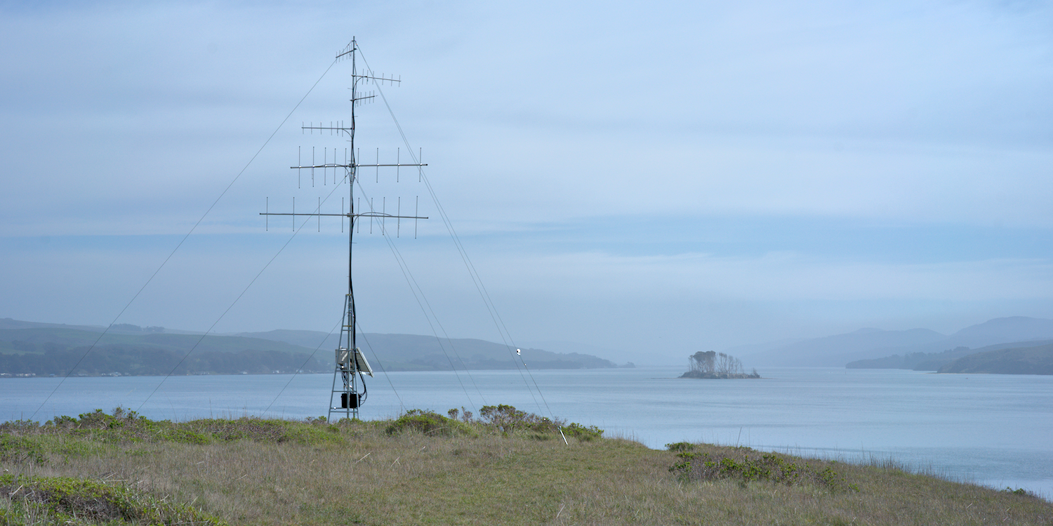
El Motus Wildlife Tracking System es una iniciativa científica comunitaria organizada por una red internacional de investigadores que a menudo rastrean organismos muy pequeños que no pueden llevar etiquetas por satélite de mayor tamaño. Este sistema combina la tecnología VHF con una red de estaciones receptoras que buscan automáticamente cualquier animal marcado con transmisores específicos de frecuencia VHF que se encuentre dentro del alcance del receptor.
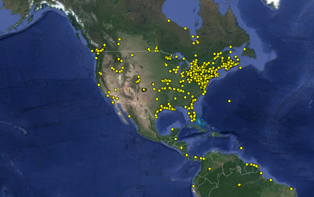
Data are centrally managed at the Birds Canada National Data Centre so, for example, if a bird that All Hands Ecology tags is picked up by a Motus station somewhere else (e.g. Mexico or Canada), All Hands Ecology is notified. Vice versa, if one of the All Hands Ecology receiving stations picks up an animal using Motus frequencies that we did not tag, our system will transfer those data to the Birds Canada data hub.
El enfoque colaborativo de la telemetría por radio/VHF ha dado lugar a uno de los mayores conjuntos de datos de seguimiento de fauna salvaje del mundo, una herramienta fundamental para los investigadores. Hasta la fecha, los investigadores han rastreado más de 25.000 aves y animales salvajes con marcas Motus.
Ampliación del alcance de Motus en la costa oeste
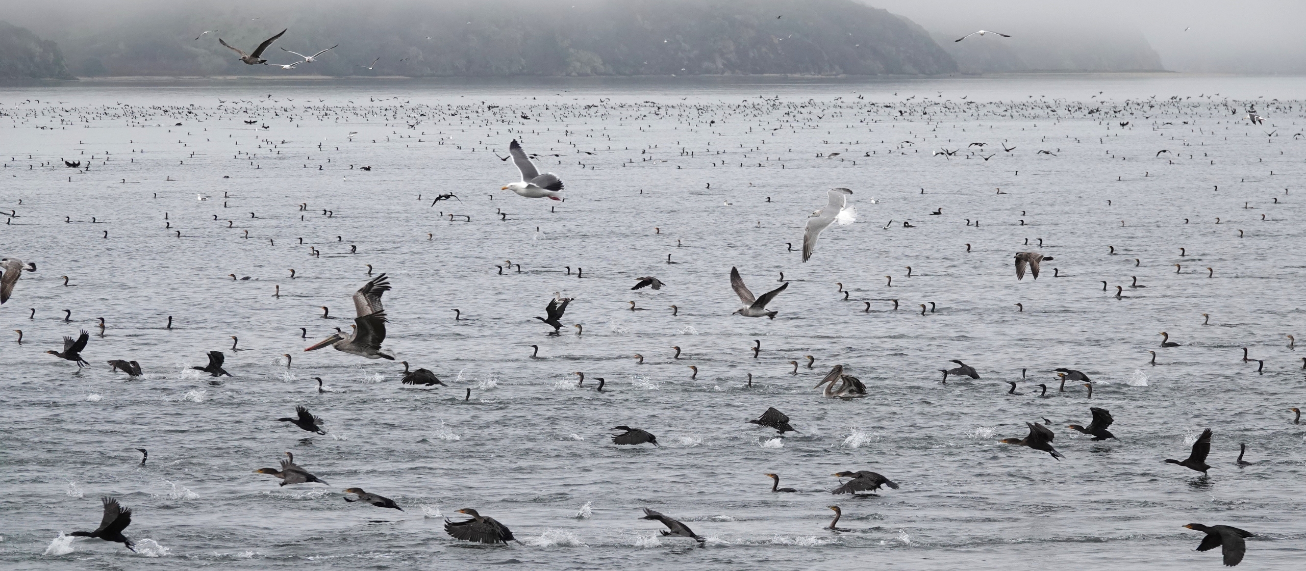
The East Coast of North America has a well-developed array of Motus receiving stations but here on the West Coast, the network is still being built—there are fewer than ten coastal stations between Victoria, BC and Baja California. That makes All Hands Ecology even more excited to announce that we now have two functioning receiving stations set up on Tomales Bay, a major migratory stopover area for many bird species.
All Hands Ecology’s focus on movement ecology
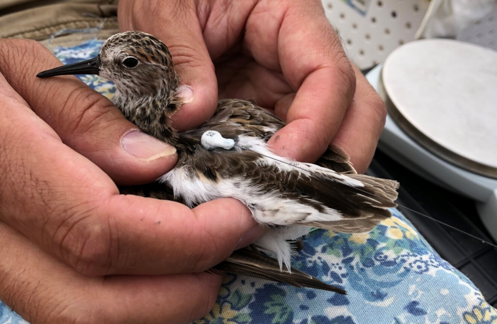
Over the past few years, All Hands Ecology science staff have been working with the Canadian Wildlife Service tagging and tracking the northward migration of Western Sandpipers. The focus of this project is to get better migration and habitat use information on Western Sandpipers when they stop in British Columbia on their way to Alaskan breeding grounds. This project has used Motus tags for the tracking.
Additionally, All Hands Ecology has begun to explore using these automated tracking stations to help us better understand how Dunlin (a declining species on Tomales Bay, as is the Western Sandpiper) use Tomales Bay in the winter.
Using technology to help us better understand how wildlife moves in and around All Hands Ecology preserves is not new (think Living with Lions project or our Great Egret telemetry project) but this project moves us further in the direction of using our lands to help understand the ecology of even smaller organisms as they transit the central coast of California.
Más información sobre la iniciativa comunitaria Motus en motus.org.
Más información sobre nuestros estudios de desplazamientos de fauna salvaje: